The power of digital systems during crisis
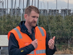
Digital systems will come into their own with COVID-19 restrictions, says James Watson of TracMap.
 increase font size

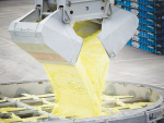
FARMERS COULD extract 20% more value from their fertiliser spend by using their fertiliser contractors' TracMap TracLink system more effectively, says the company's managing director Colin Brown.
He spoke to 50 drystock and dairy farmers at a Dargaville seminar organised by Northland fertiliser supplier and spreading contractor KD Spreaders.
Brown pins the increase to variable spreading rate maps. Made possible by cloud-stored farm mapping software such as TrackMap's TracLink system, variable spreading rate maps match fertiliser application to topography and stock behavior, rather than 'blanketing' a farm or paddock.
Brown argues that because stock stay on hillsides only long enough to graze, they tend to carry the nutrients used to grow that pasture down to 'camps' on flats.
As a result, nutrient and mineral levels on hillsides tend to drop so low that high-producing rye and clover cultivars are unable to grow and the sward reverts to browntop, kikuyu or other low feed-value, low nutrient-requirement grass varieties.
You see a similar result on dairy farms: greater pasture growth at the gate and trough parts of a paddock where cows tend to congregate, Brown says.
Fertiliser applied at blanket rates set for an entire farm don't go far enough in addressing the shortfall. While an average application rate of 230kg/ha phosphate/season is often more than enough for most farms, it doesn't go far enough to meet the nutrient needs on hillsides.
Brown recommends reducing the amount of fertiliser applied on flats and in stock camps, and spreading it instead on the hills. His TracLink system facilitates this, allowing a farmer to quickly and easily send detailed maps specifying different fertiliser application rates within paddocks to his fertiliser rep.
Developed using information from Google Earth, the online platform allows a farmer to set out a digital map of his farm, providing the fertiliser spreader with unprecedented data. This is done by first accessing the cloud-hosted system through a computer browser and plotting boundaries, fences and various farm zones on the Google Maps powered interface.
Plotting a basic map is said to take only one or two hours, even for a novice using a slow internet connection.
Plotting a more detailed variable rate map takes more time, Brown says, and may need the help of a more tech-savvy neighbour. "There's no shortage of teenagers you could pay a hundred bucks to work a mouse while you show them where to click."
With 77% of the country's fertiliser spreaders using a TracMap GPS system, it remains only for farmers to digitally map their farms and spread fertiliser strategically. Then phone the contractor.
The company has TracLink improvements in process, due for release this month. "It will make plotting farm maps much easier." Tel 0800 87 22 62
www.tracmap.co.nz
Digital systems will come into their own with COVID-19 restrictions, says James Watson of TracMap.

Farmers can now order, initiate and record fertiliser and spray applications on their farms at the click of a button.
DUNEDIN-BASED agricultural GPS business TracMap has extended its market further into Australia, signing a major new supply agreement with Kagome Foods, the country's largest tomato grower.
ORDERING AND tracking fertiliser and spray is made easier for farmers and contractors using a new system from TracMap NZ Ltd, the agricultural GPS company.

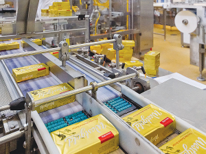
Westgold butter has been named New Zealand's tastiest in a blind tasting conducted by Consumer New Zealand.
A New Zealand agritech and dairy services group has big plans as it expands its dairy services footprint across dairy hygiene, data, and milk cooling with the purchase of nationwide refrigeration business Dairy Technology Services (DTS).
The 2026 Holstein Friesian sales season has already delivered outstanding results across New Zealand and Australia - including a new Australasian record.
OPINION: At a time when farmers are advocating for less government spending and no new taxes, the dairy sector is rightly concerned by ACT's new immigration policy.
Feilding Agricultural High School isn't alone in offering agricultural or horticultural subjects as part of its curriculum, but the location of one of its farms on the northern edge of the urban fringe makes for some interesting considerations.
Analysis of decades of research has revealed the good farming pracrtice plays a critical role in reducing nutrient losses to improve freshwater outcomes.