Kiwifruit Growers Largely Escape Cyclone Vaianu Damage
The country's kiwifruit growers seem to have escaped much of the predicted wrath of Cyclone Vaianu which hit the east coast of the North Island this month.
 increase font size
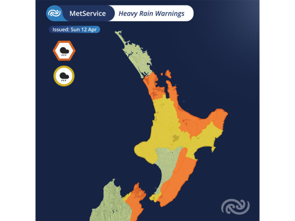 Heavy Rain Warnings are in place for much of the North Island.
Cyclone Vaianu is continuing its track south towards the Bay of Plenty, bringing with it destructive winds, heavy rain, and large swells, says Metservice.
Red Strong Wind Warnings are in place for both Bay of Plenty and Coromandel, with gusts of up to 130km/hr posing risks to life, infrastructure, transport, and power supply.
Orange warnings and watches also extend across much of the North Island.
According to Metservice, at 11:30am Sunday, the centre of Cyclone Vaianu was situated due east of Coromandel Peninsular, tracking southwards towards the Bay of Plenty.
While the centre is still offshore, the strong winds, heavy rain and large swells associated with this system are being felt far from the centre.
Overnight, gusts of over 130km/h were recorded at Mokohinau and Channel Island and 24-hour rainfall totals in Whangārei reached over 100mm.
As Cyclone Vaianu continues to move closer to New Zealand winds are set to increase, especially for regions like the Bay of Plenty and Coromandel where gusts of 130km/h are possible.
A Red Strong Wind Warning remains active in these areas until Sunday evening. Winds of these strengths bring the threat to life from flying items and falling trees.
Destructive winds will cause widespread damage including powerlines and roofs, and significant disruption to transport and power supply.
Strong Wind Warnings and Watches cover the rest of the North Island. Auckland will notice strengthening southwesterlies this afternoon as Cyclone Vaianu moves to the southeast.
Wrapping around Vaianu, bands of rain will bring some larger totals to parts of the North Island and top of the South Island. A patchwork of Heavy Rain Warnings and Watches are in place, with the heaviest rain forecast over the higher ground from the Coromandel to the east coast.
The combination of strong onshore winds, rising rivers, large swells and low pressure increase the risk of coastal inundation especially for the Bay of Plenty and round to Hawke’s Bay. Be extra cautious around the coast, especially around high tide.
Cyclone Vaianu is forecast to cross the North Island today and move between the South Island and the Chatham Islands during Monday. A Strong Wind Watch is in place for the Chatham Islands from 9pm Sunday to 9am Monday.
The country's kiwifruit growers seem to have escaped much of the predicted wrath of Cyclone Vaianu which hit the east coast of the North Island this month.

While Cyclone Vaianu remains off the East Coast of New Zealand, the Waikato Civil Defence Emergency Management (CDEM) Group says impacts have been felt overnight.
A Local State of Emergency has been declared for the Waikato for a period of seven days as the region prepares for Cyclone Vaianu to hit the area.
Specialist horticulture and viticulture weather forecasters Metris says the incoming Cyclone Vaianu is likely to impact growers across the country.
Reports of severe weather forecast to move over the vast majority of New Zealand’s kiwifruit orchards this weekend will be very concerning for a significant number of growers.


New Zealand dairy farmers are set to be the first in the world to receive access to a new digital physical milk pricing tool that enables them to fix the price for their physical milk.
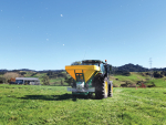
State farmer Pāmu is opening its farm gates this summer in an effort to give the rural sector the opportunity to see how large-scale, multi-system farming is delivering productivity and profitability across New Zealand.
A five-year study has found that the cost of reducing emissions without technology may be significant and unsustainable for Northland dairy farmers.
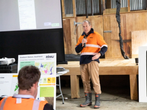
DairyNZ says Waikato farmers need certainty on Plan Change 1, but they say that certainty must be matched with practical, workable rules and a clear transition that doesn't get ahead of the new resource management system currently under review.
While the Government has moved quickly to make commercial hauliers' lot easier during the current fuel crisis, they appear to be stuck in the creep box when it comes to the agricultural industry.
Waikato farmers have been told that the Government’s new planning system legislation and the region’s Plan Change 1 (PC1) “won’t mesh together very well”.