Is augmented reality the future of farming?
Imagine a farmer being able to tell a paddock’s pasture cover and dry matter content just by looking at it, or accessing information about a cow’s body condition score in the same way.


 increase font size
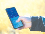
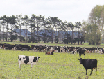
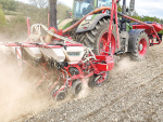
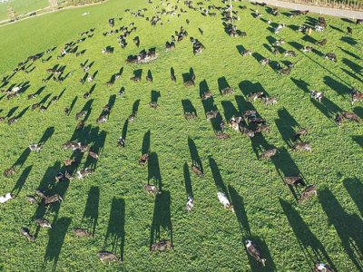 A drone photo shows how easy it is to capture images of pasture usage.
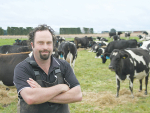
Don't wait for the technology to be proven – the age of the farming drone is here now, say two South Canterbury dairy farmers already using off-the-shelf drones in their weekly farm management.
“There’s a misconception that to use a drone effectively you must be a whizz-kid with flash cameras,” says Alastair Tremewan, “Rather, having an eye in the sky in itself, without any technical wizardry, can provide an enormous benefit.”
Tremewan, who runs a family farm near Geraldine, and near neighbour Nick Hoogeveen, general manager and part-owner of the Kintore Farms group, are both enthusiastic users of standard Phantom drones. The Phantom is an off-the-shelf model made by the Chinese company DJI, regarded as a market leader in small drone technology.
Tremewan says he got into drone use because he “loves technology”. Before returning to the family farm he had spent time in various technology-related ventures including online retail. When he saw how Hoogeveen was already using a drone on his properties he bought his own. He has since started a public Facebook page called Drones on farm NZ to promote and discuss drone usage.
Research is continuing into aerial measurement of pasture nutrient levels by a partnership of Ravensdown, Massey University’s precision agriculture group, and AgResearch, funded by the Primary Growth Partnership and led by Massey’s professor in precision agriculture, Ian Yule. The use of sophisticated hyper-spectrum cameras is central to that research.
However, Hoogeveen says he did not want to wait for more sophisticated applications to be developed. “I’m a farmer so I don’t have time for that.”
For Hoogeveen and Tremewan the primary use is visible-spectrum aerial mapping of pastures to GPS-level precision.
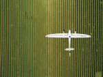
Using software from the American firm DroneDeploy, a drone can be set to autonomously run a grid over a given area, taking a series of vertical photographs that are then automatically stitched together into a single map.
“To survey one of my farms, which is about 238ha, takes me roughly 40 minutes with three battery changes. So that gives me a snapshot in time of what my farm is like at that point,” says Hoogeveen. The result is “like a fully up-to-date version of Google Earth”.
He was using it to confirm his spring rotation planning, checking that stock was grazing to target amounts.
“Over the winter we were using it to do a survey of the run-off block then we could draw on it with GPS precision where the crops had been grazed so we can see what area of crop we have left and how much we had used in the previous week,” says Hoogeveen.
Tremewan says it had allowed him to bring his maps of the farm up-to-date after decades of unmapped small changes. He had used it to plan and implement changes to the paddock fencing layout.
“I mapped over that area and was able to re-plot the size of the paddocks before we ever did anything and make sure it was all in line and that our paddock sizes would be the same.
“Once you’ve made the photo you can draw out the border and it will tell you accurately the square metreage.”
While standard drone cameras are great for mapping, assessing crop density in terms of kilograms of dry matter theoretically requires expensive aftermarket infrared cameras.
However, stock cameras have enough residual sensitivity at the red end of the spectrum to do what Tremewan calls “mock NIR (near infra-red) imagery” by fitting the lens with a filter to block out the rest of the visible spectrum.
“It’s not the most accurate thing in the world; if I was a crop farmer I wouldn’t rely 100% on it but it uses the little bit of near infra-red spectrum that’s on the camera as standard. I’ve used that overlay to show us where the cows have had too much pressure on the ground – areas where we might be looking at re-seeding, something like that,” says Tremewan.
“It’ll come up a different colour from the rest, where the grass isn’t growing, basically.”
Tremewan was also using his drone to monitor fodder beet crops over winter.
“As the cows slowly graze away the fodder beet you can run a scan over the top of the paddocks then go to your computer and drag the measurements out and work out exactly how much is left.”
Simple aerial photos taken weekly also allow him to keep track of silage and baleage stocks.
“It’s a good tool overall, even without a fancy camera, just to take photos of the paddock conditions so when we make re-grassing decisions or generally discuss the highs and lows of different paddocks, we’ve got something there to look at,” he says.
Imagine a farmer being able to tell a paddock’s pasture cover and dry matter content just by looking at it, or accessing information about a cow’s body condition score in the same way.
The unique attributes offered by vertical take-off and landing drones are transforming a range of civilian roles, from firefighting to traffic monitoring and now vineyard management.
Technology is constantly evolving, meaning products change quickly so you need to ensure improvements and upgrades are yielding value from day one. When looking at on farm upgrades, WaterForce suggests that the following are key questions in your investment research:
Drones have become increasingly popular in agriculture and horticulture over the last decade, whether taking aerial photographs of a property, checking water lines or in some cases even mustering stock. Machinery editor Mark Daniel takes a closer look at the developments in this area...
John Deere has released new software updates to its Operations Centre and MyOperations App.

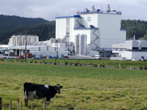
Fonterra has cemented its position as the country’s number one cheesemaker by picking up nine NZ Champion of Cheese trophies this year.
New Zealand dairy processors are welcoming the Government’s commitment to continuing to push for Canada to honour its trade commitments.
An educational programme, set up by Beef + Land New Zealand, to connect farmers virtually with primary and intermediate school students has reported the successful completion of its second year.
The Food and Agriculture Organisation of the United Nations (FAO) has welcomed a resolution adopted by the United Nations (UN) General Assembly to declare 2026 International Year of the Woman Farmer.
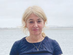
Waikato herd health veterinarian Katrina Roberts is the 2024 Fonterra Dairy Woman of the Year.
Horticulture NZ chief executive Nadine Tunley will step down in August.
OPINION: Canterbury milk processor Synlait is showing no sign of bouncing back from its financial doldrums.
OPINION: It seems every bugger in this country can get an award these days.
![]()