
Purely ‘on spec’ it has mapped Marlborough’s main vineyard district at its own expense, hoping property owners will put up their hands to buy the offered data.
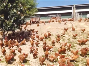
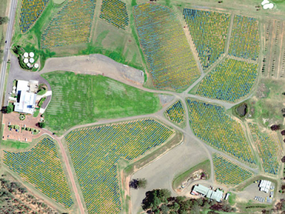
Perth-based SpecTerra mapped 49,000ha of the Wairau Valley in late summer with a fixed-wing plane carrying the company’s specialised four-channel multi-spectral camera system, designed to detect and map leaf health and density variability at high resolution.
The company is now hoping to sell the data to the various vineyard owners and sign them up for future updates.
Set up originally to map the impact on vegetation of the mining industry in Western Australia, SpecTerra now has processing staff on both coasts of Australia and in Europe, and cloud applications to manage any type of vegetation.
Managing director Andrew Malcolm says the potential benefits of aerial spectral imaging for precision agriculture are huge; the highest-value proposition is found in vineyards, for improving harvesting grape quality.
He says everyone knows there is variability in their fields, but until they start measuring it a big question mark remains on what effect the variability is having on profit.
The company has custom-surveyed some larger NZ vineyards, but precision viticulture has a problem in the start-up cost.
“So though we were doing custom surveys it was always for bigger growers who could afford to get us over there. In this case we decided to fly the whole valley ‘on spec’ at our own cost.”
Malcolm says every field varies in yield, growth potential and grape quality potential.
“But there are questions: where is it? how is it variable and what is the cost of that variability?
“This imagery allows vineyard owners to map where their zones of variability are, then start to apply management.”
The key variability to start with is soil type.
“That’s generally the driver, but in any given season that soil type might offer different growth or quality potential; so then it comes down to water availability, and from then on nutrients, pests and diseases.”
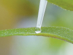
The survey was done on March 1, by the company’s equipment mounted on a Canterbury Aviation Cessna piloted by Hugh Robinson. The same setup was used for experimental surveys of wilding pines in the Mackenzie Basin for the Department of Conservation (Rural News, May 23). Flying at 5000 feet gave a resolution of about 40cm, enough to differentiate between the vines and inter-vine vegetation.
SpecTerra claims its methods are faster and more efficient than ground surveys, and give better resolution than is available from satellites and more sophisticated data from its cameras than is available from small, light drone systems.
Malcolm says independent research by Australia’s CSIRO shows that the “most predictive” time for flying is at veraison -- the onset of ripening just prior to harvest when the canopy is at peak growth.
The Wairau Valley survey coincides with the setup of a NZ agency for SpecTerra’s services, called NeoSpatial. It will be run by Karl van Turnhout, a Kiwi now living in Perth who plans to return to NZ later in the year.
Van Turnhout says NeoSpatial will offer SpecTerra’s services as well as GIS services for all forms of agriculture.
“If we’re collecting imagery across the Marlborough valley we’re also collecting imagery across orchards and fruit crops. So if those growers see any value in the data we can deal with them as well,” he adds.