NZ scientists make breakthrough in Facial Eczema research
A significant breakthrough in understanding facial eczema (FE) in livestock brings New Zealand closer to reducing the disease’s devastating impact on farmers, animals, and rural communities.


 increase font size
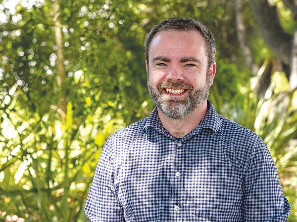 Landcare Research's Nathan Odgers is leading the project.
New tools being developed through one of the Hill Country Futures programme aims to help farmers better manage sustainability and production across diverse landscapes within their farms.
The micro-scale indicators project, led by Dr Nathan Odgers of Manaaki Whenua - Landcare Research, is running trials across two South Island and four North Island farms, measuring scale indicators - soil temperature and moisture.
This project recognises that hill country farms consist of diverse landscapes. It is designed to enable farmers to use farm scale mapping to assess which forage mixes are likely to do well in specific areas of their farm.
Hill Country Futures is a long-term $8.1m partnership programme focues on future proofing the profitability, sustainability and wellbeing of New Zealand's hill country farmers, their farm systems, the environment and rural communities.
It is co-funded by Beef + Lamb New Zealand, the Ministry of Business, Innovation and Employment (MBIE), Seed Force New Zealand and PGG Wrightson Seeds.
"Ultimately, it is hoped the project will support farmers to monitor soil temperature and moisture, to make more effective decisions, leading to improved economic, environmental and social outcomes," Odgers explains.
He says because soil conditions vary across landscapes and across farms, therefore plant conditions vary.
"We are aiming to better quantify that. For instance, if we can say, 'this north facing slope at the back of this farm will perform differently to its south facing slope,' then you can use different management approaches to measure your sustainability and production," Odgers adds.
"It's all about producing evidence to help farmers farm more sustainably and precisely than they could if they did not have farm scale mapping."
The project has been underway for two years and includes setting up wireless sensor networks on the farms, each with 20 sensors. For the past 12 months, these have been monitoring the soil temperature and moisture hourly.
"We are using that data to see how it relates to things like the aspect of a slope to see if we can map those soil properties across the farm and link that farm scale information to a crop growth model," Odgers explains.
"We are trying to predict growth of legumes over time. If we can do that at farm scale, we can provide farmers with useful information around growth rates and how they differ, depending on landscape characteristics, and model a map that provides information to help them to manage production more effectively within their farm."
The project is now at the modelling stage, with results expected by spring 2022.
"We hope that in 12 months' time we will have a portal to share this data in real time," says Nathan. "We are looking at what tools we can build to enable farmers to access and interpret the data we are collecting."
A significant breakthrough in understanding facial eczema (FE) in livestock brings New Zealand closer to reducing the disease’s devastating impact on farmers, animals, and rural communities.
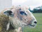
A breakthrough in the understanding of Facial Eczema (FE) in livestock could bring New Zealand closer to reducing the disease’s impact.
Reaction to the Government’s major overhaul of the country’s seven crown research organisations has so far been largely positive.
The government has announced a major restructuring of the country's seven crown research institutes (CRIs), which will see them merged into three public research organisations (PROs).
"Science is important for farmers," says Dr Suzi Keeling, Beef + Lamb New Zealand's sector science strategy manager.

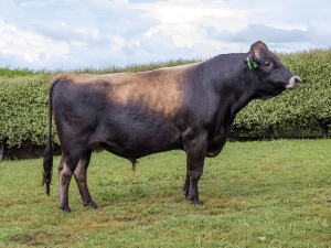
Paynes Titus Excelsior ET, an LIC bull bred by Brad Payne and Claire Brodie in the Waikato, has won the JT Thwaites Sire of the Season 2026 Award.

South Canterbury farmer Colin Hurst has been elected as the new president of Federated Farmers.
Dairy continues to be the mainstay of the country's primary export earnings.
China remains New Zealand’s biggest market, taking $23 billion of our exports, but it’s no longer a commodity story, says Prime Minister Christopher Luxon.
For Jane Smith, becoming a Ravensdown director has been a way she can actively contribute to something quite personal to her - protecting and strengthening a co-operative she deeply believes in.
Lactalis New Zealand has opened a new distribution centre in Christchurch, marking a significant investment in the company's South Island supply chain capability.


OPINION: Central Hawke's Bay farmer Mark Warren recently told the Hawke's Bay Times it's time for a conversation about allowing…
OPINION: A nation that relies as heavily as NZ does on functional global shipping lanes will have to do its…
![]()