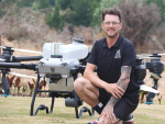
Wairarapa’s Bradley Wadsworth blends farming and technology
Bradley Wadsworth lives on the family farm – Omega Station – in the Wairarapa about 30 minutes’ drive east from Masterton.


 increase font size
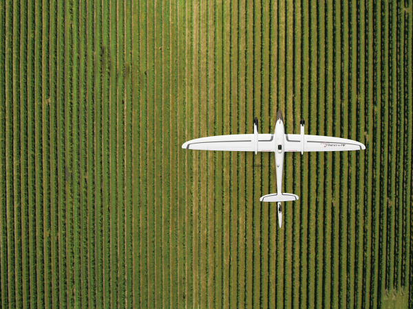
The unique attributes offered by vertical take-off and landing drones are transforming a range of civilian roles, from firefighting to traffic monitoring and now vineyard management.
Marlborough-based company GCH UAV is proving what can be achieved using drones in conjunction with advanced sensors and analytic software. The company has been operating in the province since 2017, providing aerial mapping, vineyard analytics and multispectral/thermal imagery services to vineyards.
Operations Manager Colin Aitchison, himself a drone pilot, says it offers the ability to view a vineyard from above with unprecedented levels of detail. "What is interesting about working with vineyards is the diversity of what people are requesting. What might be super important for one vineyard isn't even on the radar for the next. But once we are up flying, they are finding all sorts of value in the data."
Operating under the brand of Vineflight for its viticulture work, the company can create a digital replica of a vineyard through aerial mapping. After the data is processed, customers are presented with an accurately georeferenced map and 3D model for use in third-party GIS software.
As well as reducing operational costs and time in the field, the digital replica allows managers to understand the terrain better, more accurately measure rows or blocks and monitor change over time.
GCH UAV has also partnered with two software companies, Aerobotics and VineView, for more advanced vineyard analytics. By capturing footage of a vineyard using multispectral or thermal imagery, GCH UAV can help growers conduct analysis on such areas as crop cover removal, individual vine count, missing vine count, canopy gap measurementl, vine level vigour, and vigour zones.
The Vineyard Analytic system allows vineyard managers to assess vine health, identify missing vines and identify the extent of disease or stress. Scheduling harvest activities and making fertiliser and water management decisions can also be carried out with greater insight, says Colin. "There was a lot of hype a few years ago that this type of technology would be a massive game changer for vineyard management. But it is just another tool to help them troubleshoot and sanity check what they see on the ground. Sometimes, having that bird's eye view can explain what they are seeing on the ground and give them that bigger picture."
In one example of its work, Cloudy Bay contracted the company during two growing seasons to undertake aerial imaging of 430 hectares of vineyards. In a testimonial, Cloudy Bay Viticulturist John Flanagan said the maps they produced were an invaluable tool for ongoing vineyard management. "The service they provided has given us a very good understanding of the vigour and growth of our different blocks, which has helped to formulate customised management plans for specific sites."
Bradley Wadsworth lives on the family farm – Omega Station – in the Wairarapa about 30 minutes’ drive east from Masterton.
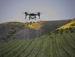
Felton Road Wines is using an electric drone sprayer to apply organic fungicides and monitor crops, cutting emissions and transforming management.
Use of agricultural drones by contractors in New Zealand is soaring.
While we are seeing more and more drones being used in New Zealand agriculture, we’re some way behind the US, where in places like the Midwest, the drones are certainly bigger than Texas.
As drones get bigger, broadacre applications like arable spraying will become more common, says the Canterburybased founder of Drone Spray, Jono Scott.
From the heights of tramping tracks to the depths of picnic baskets, a Banks Peninsular winemaker wants his wines to…
In a global wine market facing headwinds and overall decline, New Zealand Sauvignon Blanc continues to stand out as a…
From a secluded corner of South Wairarapa, Paul and Amy Mason aim to forge wines that reflect their place.