Wine Weather: La Niña Drives New Zealand’s Summer 2025–26
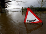
Heatwaves, flooding, thunderstorms. La Niña has strongly influenced our summer weather again as 2025 closes and we charge headlong into 2026.


 increase font size
After three years of La Niña, a change is finally upon us.
The rain-drenched areas of Gisborne and Hawke’s Bay should be in for some relief from the cloud and wet as El Niño should bring a different synoptic pattern to our weather. But there may be new challenges in spring as the westerlies return to pound parts of Aotearoa. A quick refresher for El Niño is that the increase in west to southwest winds means that the fronts and weather systems that move in from the west can race through at quite a pace. Eastern regions, where many of our grapes are grown, could be buffeted by strong winds and are also at risk of frost under clearing skies as the flow turns southwest.
El Niño and climate change:
Social media and news sites all over the world have been inundated with posts and stories around the current state of the world’s oceans and the temperature anomaly that is occurring. Arctic and Antarctic sea ice and intense heat domes are other topics that commentators are regularly pointing out.
Over hundreds of years, scientists have established patterns between our air and sea and the natural environment. We have learned more and more about our climate drivers and how they affect the day-to-day weather. The issue that is now arising is that changes to sea temperature, sea ice, and ground cover are accelerating changes to our climate. In the high latitudes and areas that have a fragile ecosystem the effects are profound and very noticeable. For example, the Antarctic sea ice record is currently at its lowest ever point for this time of year. Snow and ice cover in the arctic has depleted and this changes the albedo of these regions. The albedo is the ability of a surface to reflect or absorb energy. Snow and ice are particularly good at reflecting large amounts of energy back into space and so in recent history the poles have remained frozen all year round. Now we have accelerated warming and large areas of land and water are becoming snow and ice-free for longer. This means we have compounding problems where the exposed ground or water will absorb more energy from the sun and become warmer faster. The slow release of this energy means that these areas will stay warmer for longer. All of this is adding energy to our climate and increases the global sea and land temperature.
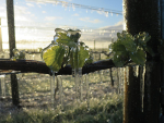
El Niño is usually the bringer of above average temperatures to the northern hemisphere and drier and normal weather for Southeast Asia. This has the potential to spill over into New Zealand, and severe droughts have occurred in El Niño years. The other effect that El Niño has on the weather of New Zealand is that it can bring cooler conditions and strong winds. We have one of the few climates where temperatures can be colder under El Niño. It often increases the risk of frost in spring for eastern regions as the alps and ranges shelter the east coast from the westerlies that roar out of the Southern Ocean. No two El Niños are the same and it will be the other climate drivers such as the Southern Annular Mode that will influence how our spring will play out.
Outlook for August and September:
Gisborne/Hawke's Bay
Mean temperatures are likely to remain near or above average through August and September and this continues the trend of the first half of 2023. The difference is that daytime maximums are likely to be milder thanks to an increased westerly flow. Nighttime minimums are likely to become cooler and near average for late winter/early spring. Warm Sea temperatures may continue to make rain bearing events more active for a time however these are expected to become less frequent and rainfall totals should be close to average. Sunshine hours should start to lift in the second half of 2023 and replace the gloom of the preceding seven months.
Wairarapa
Wairarapa should remain above average as far as mean temperatures are concerned. The diurnal range should increase as days become milder but nights become cooler. The regions should also start to become drier but southerly changes are still going to pack some punch. The lower North Island is likely to become windier through August and September as El Niño ramps up, so the risk of gale force winds about Wairarapa increases this year.
Nelson
Temperatures remain warmer than average. There may be an increase in frost through late winter and the first half of spring as the upper South Island can be well sheltered under a southwest flow. Rainfall totals are likely to be near average with rain events likely to be from fronts approaching on a strong northwest flow. As the frequency of westerly quarter winds increases there is likely to be more wind for the Nelson region through early spring.
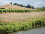
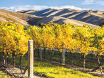
Marlborough/North Canterbury
A warmer and drier couple of months is on the cards for the east coast of the South Island, but like most other regions, cooler nighttime temperatures are expected for early spring. There is an increased risk of frost across Marlborough and North Canterbury, especially on the back of fast-moving southwest changes. Like Nelson, these regions are well sheltered from the southwest and we have already seen in July how cold conditions can become under a southwest flow. Rainfall totals are likely to be near or even a little below average. Watch for the wind as well with the possibility of northwest gales this spring.
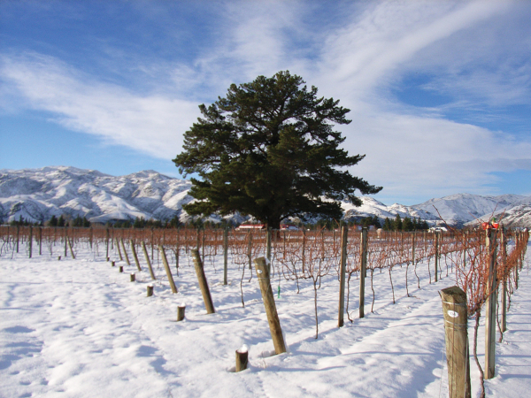
Central Otago
With a latitude that is adjacent to the Southern Ocean, Central Otago could be in for a busy time as far as weather events go. Active frontal systems may push reasonable amounts of rain well into the lower South Island and strong northwest winds are likely to be more dominant than they have been over the past five years. Mean temperatures should remain above average but there will still be a risk of frost under building anticyclonic conditions. Timing will be critical this year though as westerly winds under El Niño tend to push through fronts at a real pace and high pressure does not get much of a chance to bring settled conditions.
James Morrison runs Weatherstation Frost Forecasting: weatherstation.net.nz
Heatwaves, flooding, thunderstorms. La Niña has strongly influenced our summer weather again as 2025 closes and we charge headlong into 2026.
Many regions have experienced a wet, cloudy and grey winter.
After record breaking cold for some regions at the start of 2025 (I'm looking at you Wairarapa), there has been a steady improvement in temperatures across the country through March, and then record-breaking warmth for many parts of New Zealand during April.
I am writing this story with the 2025 harvest in full swing.


OPINION: 2020 unleashed Covid-19, and in 2021 we saw the smallest vintage in the past decade – for many wineries, tanks…
OPINION: Every vintage has it’s vagaries, and every season I am struck by how nimble viticulturists, winemakers and grape growers…
Jimmy Stewart is quite literally chipping away at circularity.
A Wine Marlborough Lifetime Achievement Award is “very premature”, say Kevin and Kimberley Judd, nearly 43 years after they came…
From the heights of tramping tracks to the depths of picnic baskets, a Banks Peninsular winemaker wants his wines to…