When temperatures consistently run above average it can come as a bit of a shock when a cold spell finally arrives.
Autumn 2024 has delivered in that respect. Over the past few years the transition from summer to winter has been relatively gentle in terms of temperature. But from the last week of April and into May there have been frosts across many regions to rival the coldest mornings of recent winters. The main cause has been the positioning of high pressure over Tasmania. This has led to an increased frequency of southwest winds and the inevitable cold fronts that race up over New Zealand. The high pressure has been remarkably intense and at times has peaked above hectoPascals (hPa). These large anticyclones can be very stubborn and do not move on easily, so it feels like we get stuck in the same pattern of weather for weeks on end. In this case the high has brought settled conditions and much colder nights as a result.
The sea surface temperature along the equatorial Pacific has been quick to cool and give early indications of a La Niña later in 2024, but just as La Niña was slow to depart in 2023, El Niño has been slow to depart this year. The result has been a drier autumn in most growing regions, following on from a dry summer. There are no clear indications yet that winter will bring a marked increase in rainfall to the regions that need it, so it may be late winter or early spring when the returning La Niña starts to bring the weather it’s known for.
Record Frosts in April and May
Fairhall in Marlborough recorded a temperature of -4.1°C on 28 April, which is the coldest morning there since 2006. From late April onwards the overnight temperatures have kept tumbling, with longstanding records challenged or broken. Several weather stations in North Canterbury recorded temperatures below -7.0°C in early May. One of the coldest temperatures recorded so far was -8.7°C at Rangitaiki on the central plateau of the North Island, a little south of Minginui in the Kaingaroa Forest, which recorded -12.0°C On 28 May 1978, the coldest North Island temperature during May. Weather records from 1978 show that a weak El Niño had been present and, like 2024, there was a predominantly southwest flow bringing cold air from the Southern Ocean.
The Winter Freeze
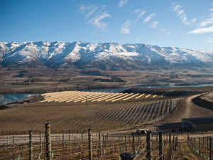
As the days get shorter and the nights longer, the lack of heating from the sun and the oblique angle of the sun’s rays striking the earth mean that under calm, settled conditions, the air gets colder. Most of New Zealand is a maritime climate, warmed by the surrounding ocean, but Central Otago is the one region that reflects a continental winter climate. In late autumn and early winter the sun continues to wane, and each day that passes there is less available energy to heat the ground and the air. Settled conditions see the maximum air temperature decline and overnight minimums can become colder and colder. Our proximity to the Southern Ocean and the winds of the “roaring forties” mean that our weather is too changeable for a freeze to last for long, but they do happen from time to time. Places such as Ranfurly and Ophir have recorded temperatures below -20°C in the past. In a warming climate it is often hard to imagine enduring these conditions on a regular basis. Even with climate change and a warming world the right synoptic conditions can and will still bring a winter freeze.
Outlook for June and July:
Gisborne/Hawke's Bay
Winter may begin on a drier note with high pressure dominating. Mean temperatures are close to average but may start to push above average through July as high pressure starts to weaken and northerly or westerly winds redevelop. Rainfall totals are expected to be a little below average.
Wairarapa
Mean temperatures are likely to run close to average through early winter, but cold southerly changes can provide a bit of a sting and June could remain quite frosty at times. That may ease later in July as milder northerly winds start to return. Rainfall totals may remain near or a little below average.
Nelson
Temperatures are likely to remain near or above average across the region but with a large diurnal range between night and day. The southwest flow is likely to lead to more frosty nights through June and this may ease in July as northerly winds redevelop. Rainfall remains below average but may increase later in July.
Marlborough/North Canterbury
High pressure is likely to see cold nights and frost continuing, but the frequency may decrease in July as northerly and northwest winds redevelop. Rainfall totals are likely to remain below average in the east.
Central Otago
The colder southwest flow means a few fronts are likely to bring a winter blast at times, followed by frosty conditions under high pressure. As the anticyclones move northwards an increase in west to northwest winds is likely. Conditions are likely to be less settled through July with mean temperatures possibly above average and rainfall remaining near or below average across the region.
James Morrison runs Weatherstation Frost Forecasting: weatherstation.net.nz


