Ravensdown Named Naming Rights Sponsor of A&P Show
Farmer owned co-operative Ravensdown has signed a two-year naming rights sponsorship of the Canterbury A&P Show.


 increase font size
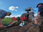
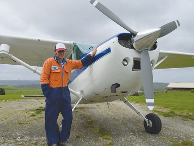 Aerowork topdressing pilot Mike Harding put on a display for attendees at Limestone Downs.
The days of trekking across hill country farms to get samples of soil fertility, then blanket spreading fertiliser, are nearing their end, says Ravensdown.
The company is trialling precision aerial spreading on eight hill country farms including the Limestone Downs property at Port Waikato.
Its aircraft use computer-controlled doors that automatically open and close according to a pre-loaded map and GPS co-ordinates.
Trials are also underway using Ravensdown’s AirScan sensing technology that maps research farms’ soil fertility to a much higher resolution than is currently achieved.
Ravensdown is backed by the Government’s primary growth partnership (PGP) funding and Massey University scientists.
The co-op says IntelliSpread and AirScan will help hill country farms lift productivity, waste less fertiliser and reduce environmental impact.
AirScan technology, which still needs validating, involves topdressing aircraft with wireless technology conducting the equivalent of up to 10,000 soil tests per hectare to work out a soil fertility map of the farm.
Last week, about 100 people from the 2017 Precision Agriculture Conference visited Limestone Downs to see the new technology. An Aerowork (Ravensdown subsidiary) aircraft landed on the farm for delegates to see.
Ravensdown technical development manager Mike White says moving from largely blanket fertiliser spreading to more precisely targeted aerial application has the potential to transform New Zealand hill country farming.
Nearly a tenth of all the land on those farms turned out to be ineffective or sensitive. Blanket fertiliser applied on these parts would have been wasted or cause environmental stress.
“We can now be more targeted in our application; areas with high potential deserve more fertiliser than those areas that are ineffective,” he says.
White says soil fertility is highly variable across a hill country farm, but trekking across that terrain to get the number of soil samples required would be impractical.
He says AirScan’s hyperspectral imaging has now put the solution in the skies for hill country farms.
Experts at Massey University are training the sensors on hill country farms as part of the PGP programme, looking at areas of deficiencies and surpluses of nitrogen, potassium, phosphorous and superphosphate.
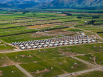
Limestone Downs is a sheep, beef and dairy farm spread over 3219ha; about 700ha is covered in bush.
Owned by the C. Alma Baker Trust, the farm runs 770 milking cows, 6800 ewes, 2500 hoggets and 100 beef cattle.
White says AirScan has been trialled on Limestone Downs to collect pasture nutrient information in the soil.
The plane carrying hyperspectral cameras flies at 600m altitude, allowing sensors “to sweep the ground”.
“A 2000ha farm would take about two hours to survey,” he says.
“The big thing is that it is giving us information to a single pixel or to about one square meter; for a hectare that is giving us 10,000 estimations of pasture nutrients across that area.
“Compared to what we are doing with soil testing this is way better.”
With the soil fertility report, fertiliser plans can be made for the farm, he adds.
The intelligence behind AirScan resembles the way a trained nutrient management adviser can use Overseer and other decision support tools to generate a map that is wirelessly sent to the fertiliser plane. That is what automatically operates the plane doors to modify fertiliser rates for targeted placement.
It is early days for the prototype IntelliSpread system, but the potential for these technologies to transform hill country farming is significant, says White.
Intelligent Fertiliser
Ravensdown's intellispread varies the rate of fertiliser applied through computer-controlled hopper doors on the plane.
Automated doors remain closed over areas where aerial spreading would be wasteful or environmentally unacceptable.
AirScan provides a unique soil fertility map of the farm. This will be wirelessly uploaded to the plane for fertiliser application.
Placement will take into account wind speed and direction, plane speed and product size and density.
Farmer owned co-operative Ravensdown has signed a two-year naming rights sponsorship of the Canterbury A&P Show.

Nominations are now open for two directorships on the Ravensdown Board and will close at 5pm, Friday 24 July 2026.
For Jane Smith, becoming a Ravensdown director has been a way she can actively contribute to something quite personal to her - protecting and strengthening a co-operative she deeply believes in.
Ravensdown has announced a collaboration with Kiwi icon, Footrot Flats in an effort to bring humour, heart, and connection to the forefront of the farming sector.
According to Ravensdown's most recent Market Outlook report, a combination of geopolitical movements and volatile market responses are impacting the global fertiliser landscape.

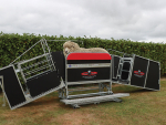
Oamaru-based livestock handling specialist Te Pari has bought Combi Clamp, the New Zealand manufacturer of Combi Clamp manual sheep handlers.
Agriculture Minister Todd McClay has admitted that a scheme bringing workers from Pacific nations to work on orchards has become too hard to navigate but says changes are coming.
A new app designed in New Zealand aims to help sheep, beef and deer farmers capture, analyse and use body condition score data more effectively.
Canterbury farmer Andy Macfarlane has been appointed to the board of AgriZeroNZ, the public-private partnership designed to accelerate the development and deployment of emissions reduction tools for New Zealand farmers.
For over 50 years Mel Ewers has been supporting the apple sector navigate through compliance and quality assurance issues.
The apple sector is enjoying a bumper harvest season.

A fair question has been raised about how member-funded organisations should conduct themselves when taking a public position on any…
OPINION: It really is getting harder to lampoon government bureaucrats when they do such a good job of it themselves.…
![]()